The Walenstöcke circuit is a demanding hike with difficulty level T4 on the hiking scale. Due to the snow fields, good footwear is mandatory. Very good physical condition and surefootedness are required. The circuit can be done from July at the earliest (depending on snow conditions). The Brunni lifts and the Hotel Engelberg offer the hike as an attractive package with local hiking guide and two nights with half board from CHF 321 per person (surcharges for small groups of less than 4 people).
ROUND WHALE STICKS
You have to walk around the 7 sticks...
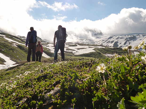
In the course of the 19th century, wild ungulates in Switzerland were hunted so heavily that red deer and ibex were considered completely extinct in Switzerland. So that the wild animal populations could recover and the extinct animals could be reintroduced, federal hunting bans were created at the end of the 19th century. From then on, hunting was prohibited in these areas. Today, the hunting ban areas have the character of a nature park. Two of these protected zones are around the Walenstöcke. An impressive hike leads through the middle of the breathtaking fauna conservation areas.
Since 1952, an aerial cableway has provided access to the sunny "Brunni" terrace above Engelberg. Today's ultra-modern aerial cableway has room for 65 people and allows you to save your energy for the hike right at the start and comfortably climb 600 metres in altitude. The chairlift Ristis-Brunnihütte can take off another 230 metres in altitude. The use of the transport facilities should be well considered, as the circumnavigation of the Walenstöcke is a strenuous undertaking: The hiking time for the 25 km route is actually 8.5 hours and there are 1,435 metres of ascent and descent each. The hike can alternatively be done as a leisurely two-day tour, and there are six places to stay along the way. With a little ambition and a high walking pace, the circumnavigation can also be done in 7 hours.
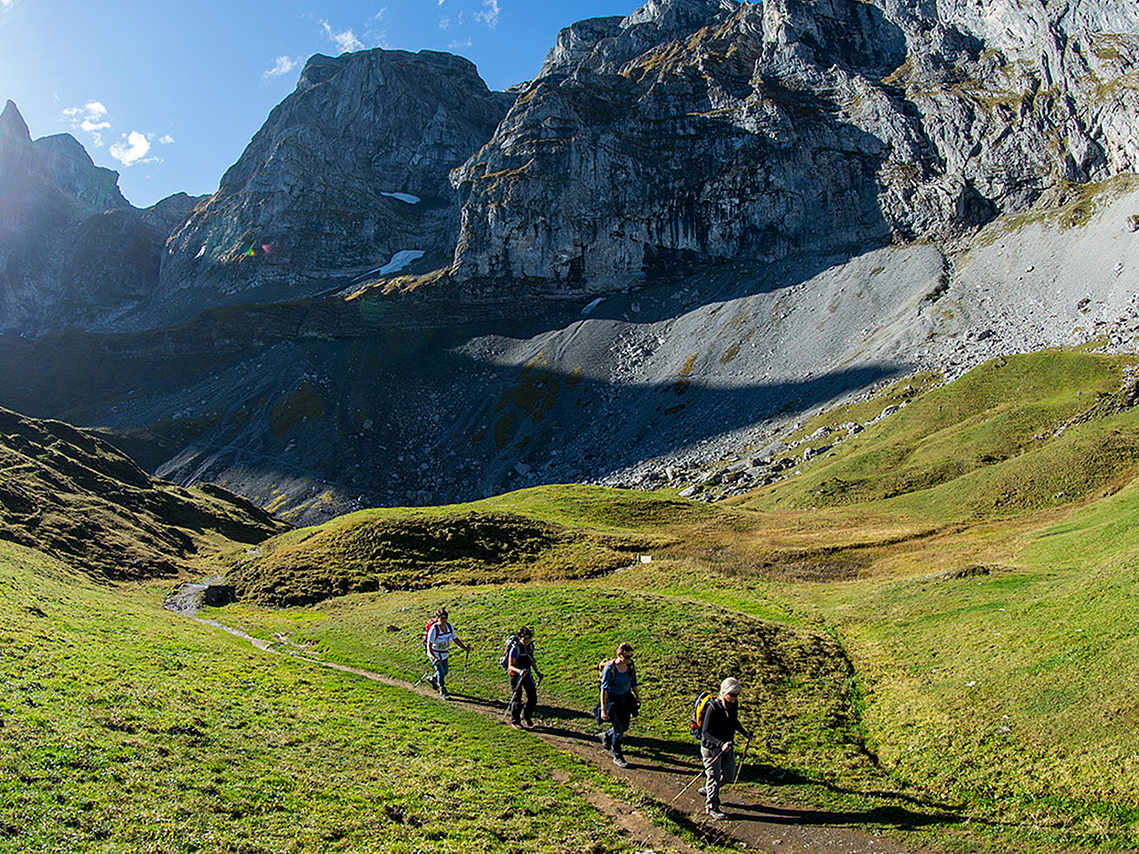
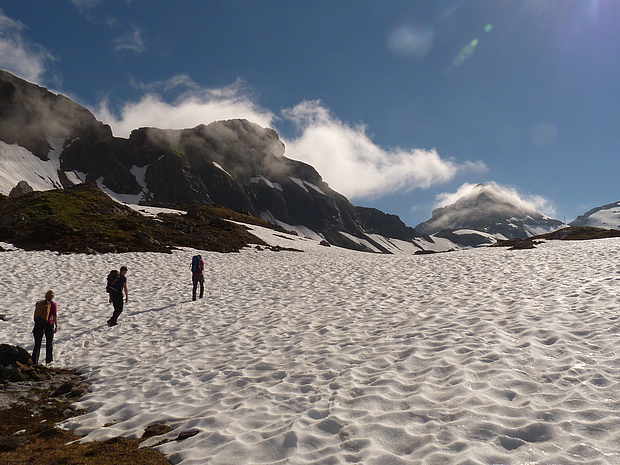
In summer, the Engelberg-Ristis cable car carries the first hikers up to 1605 m as early as 7.30 a.m.. You would love to pause at the sight of Engelberg's mountain panorama with its mighty 3000-metre peaks and stop for a bite to eat on the sun terrace of the Berglodge Restaurant Ristis, but the mountains are calling and in the morning freshness your feet carry you up the gentle ascent to Rigidalalp as if by themselves. It turns out that the temptations on the circuit are great, because you could also enjoy yourself at the Älplerbeizli Rigidal, just 30 minutes further on. But after a nippy ascent, you dive into the federal hunting ban area. On the right, the view opens up into the depths: "End of the world" is the name of the game down there. In view of the high rock faces around the basin, from a frog's perspective the world does indeed seem to have come to an end down there. Up here, however, a new world opens up with a high plateau and the first stage destination on the horizon: the Rugghubelhütte SAC at 2,290 metres above sea level. "That's another 20 minutes at the most", you think to yourself, but the Rugghubelhütte gets bigger and bigger and somehow you don't get any closer to it. As the victim of an optical illusion, after a total of 2.5 hours of climbing you are particularly pleased about the first big break of the circuit. Hut warden Chrigel Menon and his team take care of your physical well-being while you watch the droll marmots around the hut. Chamois and ibex can also be spotted with a trained eye, thanks to the hunting ban area.
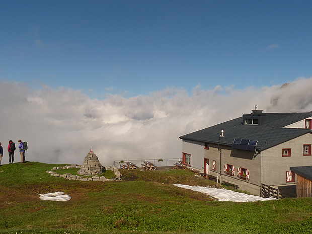
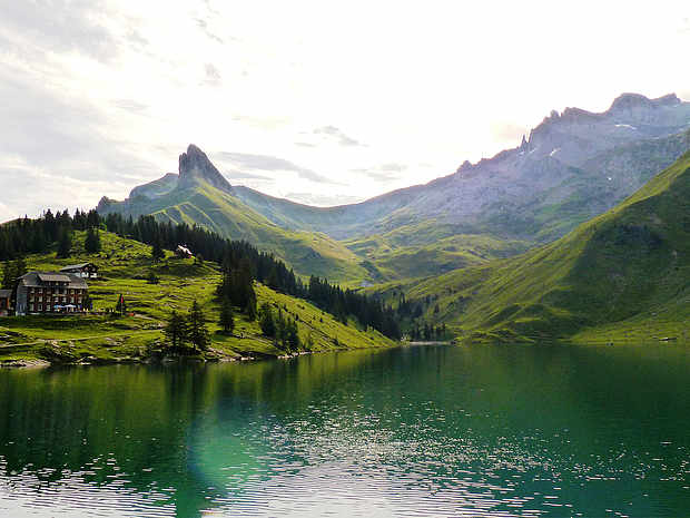
From the terrace of the Rugghubel hut, you can study the mountain formations, which are appreciated by bearded vultures and paragliders alike for cross-country flights because of the good thermals. Most of the 7 visible peaks are flat at the top. They are therefore not "horns" but "sticks". For formations with flat summit plateaus and less pronounced main peaks are called sticks: Walenstock, Rigidalstock (incidentally an exciting via ferrata tour), Ruchstock, Scheyeggstock, Laucherenstock, Hasenstock and, almost as if decapitated, the Sättelistock. Exceptions prove the rule, because when the gaze wanders further east, it captures a red pyramid the likes of which the Egyptians could not have built better: The Engelberg Rotstock (2,818 m.a.s.l.). Add 1.5 hours for a steep ascent and descent and you have a phenomenal panoramic view of the Uri Alps. However, this is too much for the one-day tour, and so before the 8th floor you only go up to the Rot Grätli (2,559 m.a.s.l.), behind which large snowfields are still hiding even in high summer. A quick slide makes the descent easier. Now a gentle up and down leads through beautiful alpine meadows until you see the idyllic Bannalpsee far below from the Bannalper Schonegg (2,250 m.a.s.l.). There we turn onto the Walenpfad, one of the most beautiful high-altitude hikes in Switzerland. As soon as we reach Walegg (1,951 m.a.s.l.), we know why: the view down into the Engelberg valley, which penetrates deep into the mountains, to the small Stanserhorn and Lake Lucerne is awe-inspiring. Along the Walenpfad there are almost hourly opportunities to stop for refreshments in rustic alpine inns. Through a high mountain forest you reach Rosenbold (1,865 m.a.s.l.), where you again see the same majestic mountains as at the beginning of the tour. Now it is not far to the Berglodge Restaurant Ristis. By the way, since August 2016 you can stay there in one of the 7 rooms with a total of 41 beds.
MORE INFORMATIONS
Author
Text and pictures: Thomas Küng


