Hiking trails

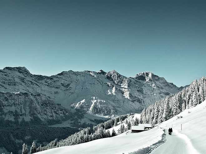
Hiking with far-reaching view, breathing in fresh alpine air, giving your circulation new wellbeing, breathing in the scents of flowers, giving your senses new experiences: Over 500km of hiking trails invite to be discovered.

Hiking Trailrecommended route

Ristis - Rigidalalp - Brunnihütte

Hiking Trail · Switzerland
Logo Engelberg-Titlis Tourismus
Responsible for this content
Engelberg-Titlis Tourismus Explorers Choice 
  • Brunnihütte_SO
    Brunnihütte_SO
    Photo: Engelberg - Titlis Tourismus, Engelberg-Titlis Tourismus
Hiking on the sunny side of Engelberg with a perfect view of the Titlis and the local mountain Hahnen - this is not an empty promise on the panoramic trail Ristis - Rigidalalp - Brunnihütte.
moderate
Distance 1.6 km
1:05 h
265 m
3 m
1,860 m
1,597 m

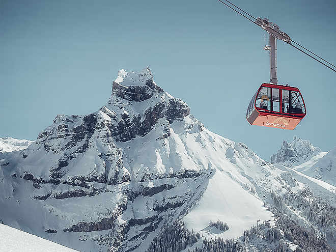
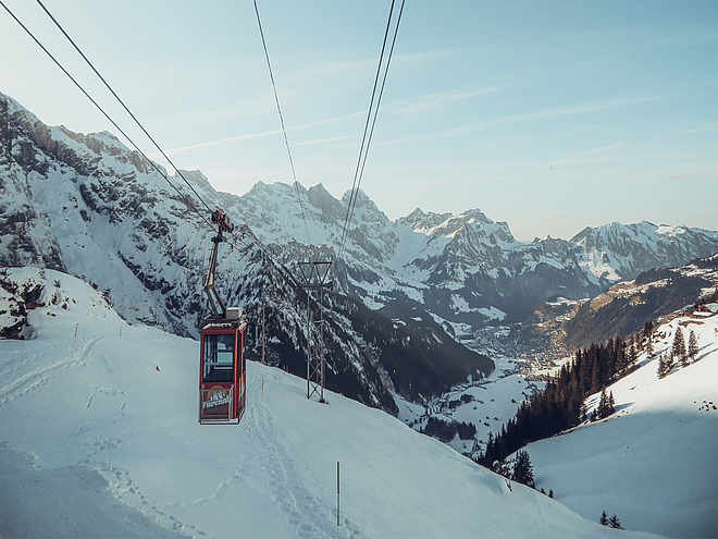
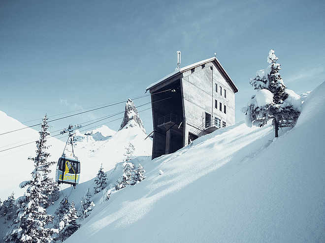
From Engelberg train station, the free local bus takes you to Brunni valley station, from where you can take the Brunni cable car up to Ristis. Here you have reached the starting point of the Panorama Trail. Always slightly uphill and with breathtaking views you walk on the well prepared hiking trail towards Rigidalalp. In good weather, the photo subject "Hausberg Hahnen" presents itself from its best side and stands out with its imposing planks against the bright blue sky. After half an hour's walk, you reach the Rigidalalp mountain inn. In good weather, guests are offered rustic coziness and Engelberg specialties. Once you have had your fill of refreshments and the view, you can start the ascent to the Brunnihütte. After a few minutes of ascent, the SAC hut is already in sight. The large sun terrace offers space for sun-seekers and tired hikers. What better way to end a day of hiking than with a delicious hut café and a view of the Titlis? Then it's a comfortable ride back down to the valley with the chairlift and from Ristis with the cable car.


Author’s recommendation

If you prefer to go downhill, take the chairlift from Ristis to the Brunnihütte and start the panorama trail there.
Profile picture of Engelberg - Titlis Tourismus
Author
Engelberg - Titlis Tourismus 
Update: May 25, 2022
Difficulty
moderate
Stamina
Experience
Landscape
Highest point
1,860 m
Lowest point
1,597 m
Best time of year
Jan
Feb
Mar
Apr
May
Jun
Jul
Aug
Sep
Oct
Nov
Dec

Track types

Asphalt 29.86%Forested/wild trail 17.62%Path 52.49%
Asphalt
0.5 km
Forested/wild trail
0.3 km
Path
0.8 km
Show elevation profile

Tips and hints

Mountain Railway prises

Timetable mountain railroad

Gastronomy

Montain Lodge Ristis

Älplerbeizli Rigidal

Brunnihütte SAC

Start

Ristis
Coordinates:
SwissGrid
2'673'901E 1'187'240N
DD
46.832207, 8.407289
DMS
46°49'55.9"N 8°24'26.2"E
UTM
32T 454797 5186688
w3w 
///lofts.decoding.essay

Destination

Brunnihütte SAC

Turn-by-turn directions

Ristis-Rigidalalp-Brunnihütte

Public transport

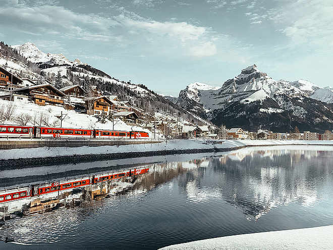
National and international connections (from Zurich airport connections every half hour with approx. 1h travel time) to Lucerne. Then with the Zentralbahn in 43 minutes through varied landscape and gorges up to Engelberg.

From Engelberg station the free sports bus  takes you directly to the valley station of the Brunni cable cars.

Directions

By car, take the A2 (Basel-Gotthard) to Stans Süd, then take the main road 20 km to Engelberg. Engelberg is 30 minutes from Lucerne, 1 hour and 15 minutes from Basel, Zurich or Bern.

Parking

Parking spaces are available in Engelberg for a fee.

Coordinates

SwissGrid
2'673'901E 1'187'240N
DD
46.832207, 8.407289
DMS
46°49'55.9"N 8°24'26.2"E
UTM
32T 454797 5186688
w3w 
///lofts.decoding.essay
Get there by train, car, bike, or on foot!

Equipment

Sturdy shoes, sun protection and hiking poles are an advantage.

Similar routes nearby

  • Rugghubelhütte (alt. 2,290m)
  • An alternative to the Walen Trail and Benedictine Way
  • Walenstock peaks circular hike
  • Walenpfad - 2 Tages Wanderung Innerschweiz
  • Walenpfad Ristis–Bannalp
 These suggestions were generated by our system
Difficulty
moderate
Distance
1.6 km
Duration
1:05 h
Ascent
265 m
Descent
3 m
Highest point
1,860 m
Lowest point
1,597 m
Refreshment stops availableFamily-friendlyDog-friendly

Weather at the route's trailhead

Statistics

  • Content
  • Show imagesHide images
Features
Maps and trails
Distance km
Duration: h
Ascent m
Descent m
Highest point m
Lowest point m
Push the arrows to change the view